Navigation
How to Find Polaris and True North (and Why Your Compass Is Wrong)
Everything in night-sky planning is a bearing from true north: the azimuth of moonrise, the direction of the Milky Way core, the spot on the ridge where a planet sets. A compass doesn't point to true north. It points to magnetic north, which in 2026 is anywhere from 1° to 27° from true north depending on where you stand, and a phone compass adds errors of its own. The sky is more reliable. This guide covers how to find Polaris and the celestial poles, how far off a compass really is, and how to get true north in the field to the accuracy each job needs.
At a glance
- Polaris: follow the Big Dipper's pointer stars, Dubhe and Merak, five times their own spacing. It's magnitude 2.0, the 47th-brightest star, not the brightest.
- Latitude check: Polaris is as many degrees above the horizon as your latitude, so 40° up at 40° N.
- Not quite the pole: about 0.6° (roughly 38′) off in 2026, and it circles the true pole once a day.
- Compass error: declination is −12.5° in New York, +14.9° in Seattle, +12.8° in Sydney. Correct for it or use the sky.
- Accuracy needed: ±5° for wide star trails, ±0.5° for the Moon behind a landmark at 200 mm, arcminutes for tracked deep sky.
How to find Polaris from the Big Dipper or Cassiopeia
Polaris is the end star of the Little Dipper's handle, but the Little Dipper is faint and hard to pick out from a town. Here's how to find Polaris using the brighter stars nearby instead.

.jpg)
- From the Big Dipper. Find the two stars forming the outer edge of the bowl, Merak and Dubhe, the "pointers". Draw a line from Merak through Dubhe and extend it about five times their separation. The first fairly bright star you come to is Polaris. The Dipper circles the pole, so the line may point up, down or sideways depending on the season and hour, but it always ends at Polaris.
- From Cassiopeia. When the Dipper is low (autumn evenings from mid-northern latitudes), the W of Cassiopeia is high on the opposite side of the pole. A line from the W's middle star out through its open side reaches Polaris at roughly the W's own width.
- Check the brightness. Polaris varies slightly around magnitude 1.98, about the same as the Dipper's stars. If the star you've found is very bright, it's Vega, Capella or a planet. There's nothing that bright near the pole.
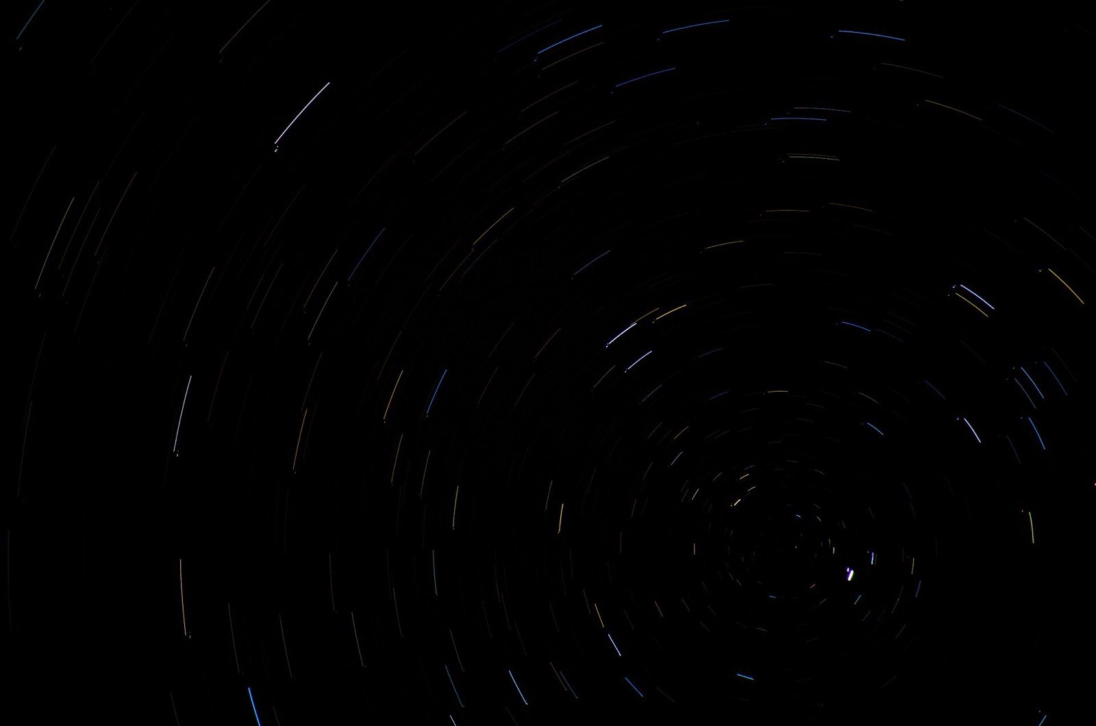
Every other star circles it through the night. Polaris stays within about a degree of the same spot, and that's why it's useful. It also tells you your latitude. The altitude of the celestial pole equals the observer's latitude (on the horizon at the equator, overhead at the geographic North Pole, 40° up at 40° N) because your horizon is tilted from the Earth's axis by exactly that angle. Sailors measured Polaris with a sextant, or with a fist at arm's length (about 10°), and got their latitude to within a degree or two.
Polaris isn't exactly at the pole
Polaris is close to the north celestial pole, not on it. Its offset was 39.6′ in 2018 and is about 38′ in 2026, roughly 0.6°, a little more than a full Moon's width, so it moves in a small circle around the true pole once a sidereal day. For naked-eye orientation this hardly matters, because a bearing on Polaris is within about a degree of true north at any hour. For a tracking mount it matters a lot (see polar alignment, below).

The offset is shrinking. The Earth's axis precesses. It wobbles like a slowing top under the pull of the Sun and Moon on the equatorial bulge, and the pole moves around a circle of sky about 47° across every 25,772 years. The pole is drifting toward Polaris, passes closest around 2100 at about 27′, then moves away. Around 2800 BC the pole star was Thuban in Draco, within 10′ of the pole when the pyramids were built. Around AD 14,000 Vega will be the nearest bright star to the pole, though still some 5° off. You don't need any of this for planning.
No Polaris in the south: use the Southern Cross
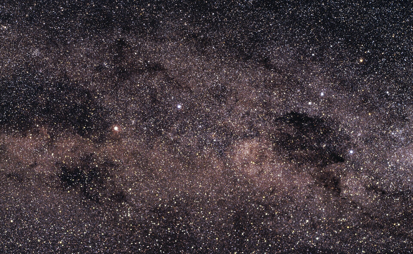
The nearest naked-eye star to the south celestial pole, Sigma Octantis, is magnitude 5.47, barely visible from a dark site and invisible from a town, and about a degree from the pole. Use the Southern Cross instead.
.jpg)
- Find Crux, the compact cross of four bright stars, and the two "Pointers", Alpha and Beta Centauri, nearby in a line aimed at the cross.
- Extend the long axis of the cross from Gacrux at the top through Acrux at the foot, four to four-and-a-half times its own length. The pole lies near the end of that line, in blank sky.
- Cross-check with the Pointers. A perpendicular bisector of the line joining Alpha and Beta Centauri meets the extended cross axis at the pole.
- Drop a vertical from that point to the horizon. That's true south. The pole's altitude equals your latitude, 34° up in Sydney.
Still Dark works in true north throughout. The compass card and the 360° sky are corrected for magnetic declination, mark both celestial poles and Polaris, and give the azimuth of any object you search for. In AR mode the drawn pole should sit on Polaris. If it's a few degrees off, move away from metal and recalibrate.
True north vs magnetic north: how far off is your compass?
True north is the direction to the geographic pole, where the Earth's axis meets the surface. Magnetic north is where the needle points. That's the north magnetic dip pole, which is nowhere near the geographic pole and doesn't stay still. In the 19th century it was in the Canadian Arctic islands. It has since crossed the Arctic Ocean, passed near the geographic pole in the late 2010s, and is now on the Siberian side. Its speed peaked at 31–37 miles per year and has slowed to about 22 miles per year, the sharpest deceleration on record, according to the World Magnetic Model 2025 released by NOAA and the British Geological Survey on 17 December 2024.
The angle between the two norths at your location is the magnetic declination. East declination means the needle points east of true north. To get a true bearing, add east declination to the compass reading and subtract west.
| City | Declination, Sep 2026 (WMM2025) | Needle points |
|---|---|---|
| New York | −12.5° | west of true north |
| Denver | +7.5° | east |
| Seattle | +14.9° | east |
| Anchorage | +14.0° | east |
| London | +1.2° | east |
| Sydney | +12.8° | east |
| Cape Town | −26.8° | west |
From NOAA's declination calculator for 12 September 2026, uncertainty about ±0.4°. Values drift by up to a quarter of a degree a year, so look yours up rather than trusting an old map.
Why your phone compass is wrong too
A phone's compass is a magnetometer the size of a rice grain. It measures the total field where the phone is and can't tell the Earth's field from anything nearby.
- Magnets in cases and mounts. Folio clasps, MagSafe accessories and magnetic holders can swing the reading by tens of degrees.
- Cars, tripods and railings. Steel within three feet bends the field. An aluminium tripod is usually fine, but a steel head or a car roof is not.
- Calibration. A figure-of-eight, or a rotation through all three axes, lets the phone re-solve its own magnetic offset. Repeat after any change of case or location.
- Magnetic versus true. By default the iPhone's Compass app shows magnetic north. Turn on Settings → Compass → Use True North to apply the declination for your location. Apps that read the heading can make the same correction. Those that don't are off by the full declination.
Even then a phone heading is only good to a few degrees. That's enough to find a constellation but not to align a mount.
How to find true north in the field
A planetarium app doesn't need a compass to know where north is on the sky. From your position and the time it computes every object's altitude and azimuth, and azimuth is measured from true north by definition. The app only uses the compass to work out which way the phone is pointing when you hold it up. That's the part that goes wrong, so check it against the sky.
The Sun is the easiest reference. At local solar noon it crosses your meridian. That's due south from anywhere north of the Tropic of Cancer (23.4° N) and due north from anywhere south of the Tropic of Capricorn. But solar noon isn't 12:00. It shifts four minutes for every degree of longitude from your time zone's centre, an hour in summer time, and by the equation of time, which puts the Sun up to 16.5 minutes fast on 2 November and 14.2 minutes slow on 11 February. The Sun & Moon card gives the solar noon time. Use that, not the clock.
- Sun and a shadow stick (day). Push a straight stick into level ground and mark the tip of its shadow. Mark it again 15–20 minutes later. The line from first mark to second runs west to east, so its perpendicular is north–south, good to a few degrees. It's more accurate to mark the shadow at solar noon, when it points at true north (true south in the southern hemisphere).
- Polaris (night). Drop a vertical from it to the horizon. Good to about 1°, with no equipment. In the south, the Crux construction gives 2–3°.
- An AR sky overlay. Turn until the drawn Polaris, Moon or Sun sits on the real one. The heading error is now cancelled and the on-screen bearings are true. Note a landmark at the azimuth you need.
- A compass with the declination set. Stand clear of the tripod and read to ±2°, which is enough for wide fields and for setting up before dark.
Why true north matters for night photography
Star trails circle the celestial pole, so the pole is the centre of the composition. To centre the rings in a 24 mm frame you need to place it to within a few degrees. The Milky Way core is low in the south from northern latitudes, at a specific azimuth for the date and time. Moonrise, moonset and sunrise azimuths are true bearings. A hand at arm's length spans about 10°, so an uncorrected 12° declination puts the Moon more than a hand's width along the horizon from where you stood waiting. At 200 mm that's several frame-widths away.
The Planner draws the Sun and Moon rise, set and current-position lines on the map in true bearings, with the field-of-view wedge for your focal length and sensor laid over them. Use "stand here" to place the Moon behind a landmark, then confirm on site by matching the AR sky to the real one rather than by compass.
Polar alignment for star trackers
A tracker needs its rotation axis parallel to the Earth's, pointed at the true pole, not at Polaris 0.6° away. Most trackers have a polar scope whose reticle shows a circle of the right radius with hour marks like a clock face. Polaris goes on that circle at the clock position set by its hour angle, which is where it currently is on its daily circle around the pole. Any planetarium app that draws both the pole and Polaris shows this. Read the angle from pole to star, rotate the reticle to match, and put Polaris in the gap.
The rough method for wide fields is quicker. Set the wedge to your latitude, level the tripod, and turn the base until the axis points at Polaris by eye. That leaves about a degree of error, which is enough for a couple of minutes at 50 mm but not for long lenses. In the south, use the reticle's Octans triangle (Sigma, Tau and Chi Octantis) or an electronic plate-solving aid.
| Task | North accuracy needed | Method |
|---|---|---|
| Wide star trails, 14–24 mm | ±5° | Polaris by eye, or a corrected compass |
| Moonrise behind a landmark, 200 mm | ±0.5° | Planner, then AR match on a horizon feature |
| Tracker, 2-minute subs at 50 mm | ±0.5° | Polar scope, Polaris on the circle |
| Deep sky at 400 mm and up | arcminutes | Polar scope plus drift or plate-solve refinement |
Common mistakes
- Looking for the brightest star. Polaris is second magnitude. Vega and Capella are much brighter and nowhere near the pole.
- Reading a compass beside a tripod or car. Step ten feet from any steel first.
- Getting the declination sign backwards. Add east, subtract west. If you reverse it the error doubles, to 30° in Seattle.
- Aligning a tracker on Polaris itself. Put it on the reticle circle at the right hour.
- Assuming solar noon is 12:00. Longitude, summer time and the equation of time can move it by an hour or more.
FAQ
Is Polaris the brightest star in the sky?
No. It's magnitude 2.0, about the 47th brightest. It's known for staying in one place, not for being bright.
How accurate is Polaris for finding north?
To about 1°. It's 0.6° from the true pole in 2026 and circles it daily, so its bearing wanders up to roughly 0.8° either side of true north from mid-northern latitudes.
Does the iPhone compass show true north?
Not by default. Turn on Use True North in Settings → Compass and it corrects for your local declination. Keep the phone away from magnets and steel.
How far is magnetic north from true north?
About 1° in London, 12.5° in New York, 15° in Seattle, 27° in Cape Town in 2026. Look yours up with NOAA's calculator, because it changes from year to year.
Sources and further reading
- Wikipedia — Polaris (magnitude 1.98, range 1.86–2.13; 39.6′ from the pole in 2018, closest about 0.45° around 2100; 47th-brightest star).
- Wikipedia — Pole star and Axial precession (25,772-year cycle, Thuban c. 2800 BC, Vega c. AD 14,000, Sigma Octantis magnitude 5.47, altitude equals latitude).
- NOAA NCEI — World Magnetic Model 2025 Released (release date, NOAA/BGS partnership) and the Magnetic Declination calculator (city values in the table).
- ExplorersWeb — The Magnetic North Pole's Mad Dash Is Slowing Down (BGS figures: 50 km/yr peak, 35 km/yr now, motion toward Siberia).
- EarthSky — The Southern Cross is your guide to due south (Crux and Pointer constructions) and What is the equation of time? (+16.49 min on 2 Nov, −14.24 min on 11 Feb).
- Apple Support — Use the compass on iPhone (Settings → Compass → Use True North).